Saturday, December 31, 2011

2011 12-31 Daisy Mountain


Length: 8.7 miles

Duration: 6 Hours 11 minutes

Vertical Up: 3491 feet

My track log at EveryTrail


I've been lazy lately. A recent bought with the flu combine with the dark, dark mornings of winter have conspired to keep me away from the treadmill in the morning.  Combine that with a few good holiday meals and I've become quite a slug.  I know I've put back on some weight but I'm too chicken to see how much.

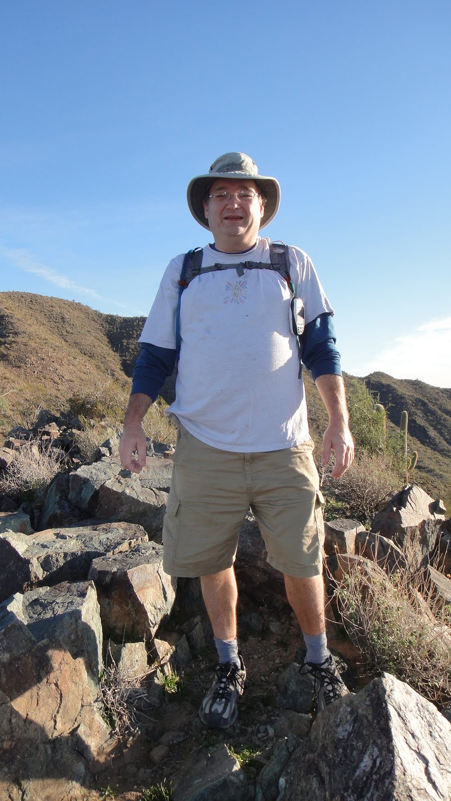
Since the year was drawing to a close, I decided to end this year of transformation with a hike to the same place my year began - Daisy Mountain.  I wanted to hike with some new friends and neighbors so I put out the notice that I was hiking.  I was happy that six others decided to spend the last day of the year hiking up to the summit with me.


I wanted to start the morning at first light so we agreed to meet at 7:30.  As described here a couple of times, the hike starts out with about 1 1/2 miles of flat hiking.  I have come to name this portion the "Parkside Penalty".  As it turns out, if you start the hike up Daisy Mountain from the Anthem Country Club, you can avoid this long, monotonous section of the hike.


Since I've described the hike a few times in this blog, I'm not going to go into details about the hike.  The part of the hike that was interesting today was that I was one of the stronger hikers (and I'm not use to that).  So the journey up to the summit was a mixture of tough verticals, tour guide and cheerleader.  After a few hours we had all made it to the saddle area just below the first summit.  This is where we shared water with two ladies hiking to the top with NO WATER.  It always amazes me to see people hiking with nothing.


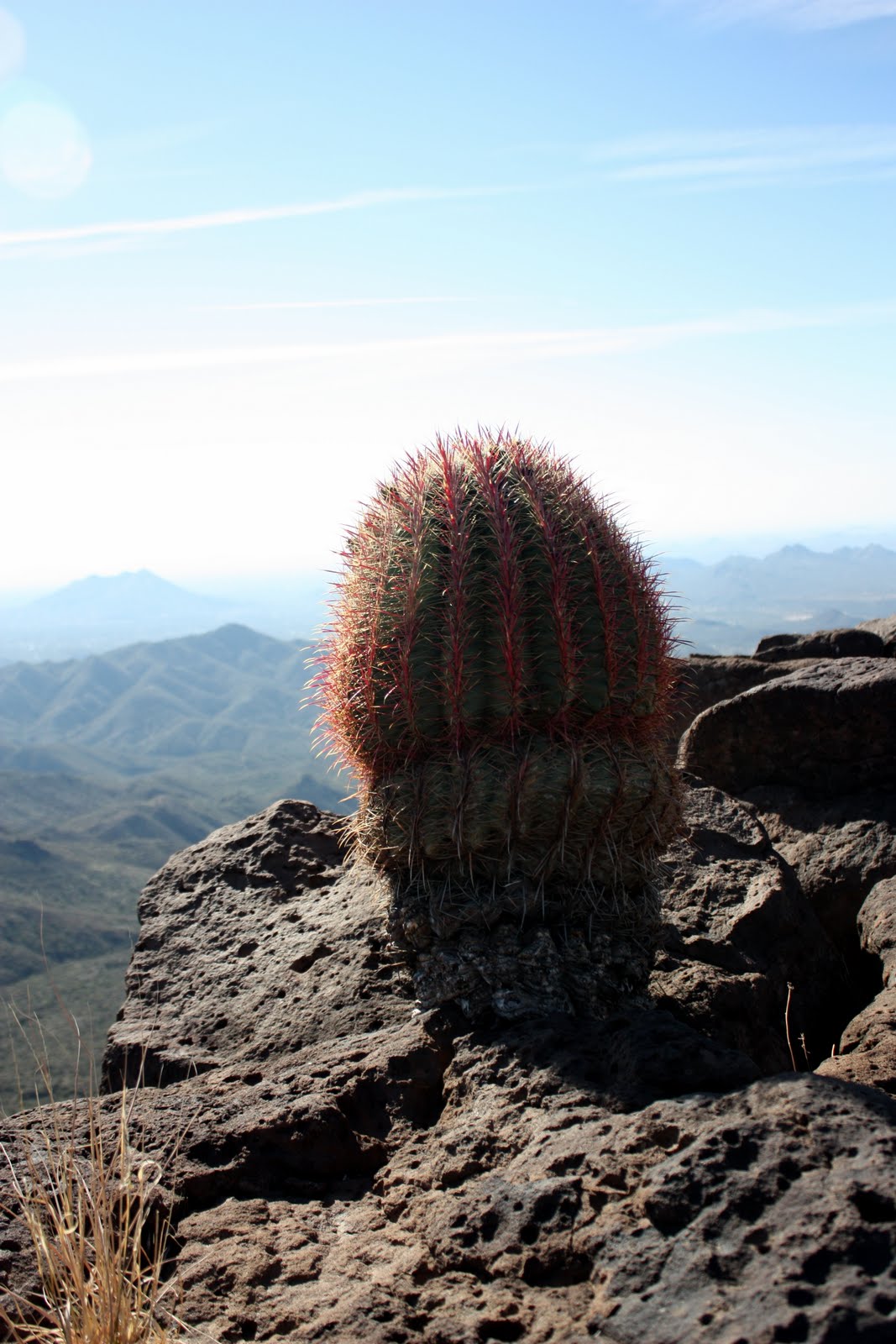
After a short steep hike we reached the summit.  It was such a beautiful day for hiking.  This is the kind of day that I envision people taking brochure pictures for Anthem.  After a short lunch break we headed down.  The downhill leg was filled with a bit of excitement as one of our party decided it may be quicker to roll down the mountain.  After thinking better, she grabbed a rock to stop her fall.  Luckily all we had to deal with were scrapes and bruises - nothing broken!

The fall slowed our decent somewhat as we were being extremely careful on the steep areas.  About halfway down we stopped at our last geocache.  this was where I heard from Jim and his 9 year old daughter.  We had though they turned around at the saddle but they pressed on and made it to the summit.  Quite an achievement for a 9 year old!  Knowing they had to come down the backside (and because I was their ride home), I said goodbye to the main group and went back to hike with Jim.


We met at another cache up the hill and made our way back down, through the "Parkside Penalty" and back to the car.

This was a great hike and a fabulous way to end 2011!

Sunday, December 11, 2011

2011 12-11 Skull Mesa


Length: 11 miles

Duration: 7 Hours 19 minutes

Vertical Up: 3684 feet

My track log at EveryTrail


About two years ago I went on a hike to Skull Mesa.  The hike was described with the following disclaimer “The terrain can and will be difficult at times so be prepared. The hike might take anywhere from 6 - 8 hours depending on how fast (or slow) we hike.”  I never made it to the top of Skull Mesa and the group ended up finishing the hike 10 hours later in the dark.

This failure has weighed on my mind for a while.  I’ve wanted to try this hike again now that I am in a little better physical shape.  With the help of a hiking club I am a member of, I arranged a geocache event to Return to Skull Mesa.

The Skull Mesa hike can be broken up into three legs: Hiking the river, hiking across to the base and the final assent to the summit.  A better description of the route can be found at the Hike Arizona site

View of Skull Mesa from the Parking Area


Hiking the River


Looking back at Cottonwood Creek
The group met at 8 AM at the parking area of the Spur CrossRanch Conservation Area on a particularly cold morning in December.  In all, seven people and two dogs were brave enough to start hiking with temperatures in the 40s.  At the start of our hike, the sun had not peaked over the surrounding hills and the wind was whipping around.  It was cold.

We all paid our $3.00 and began the first leg of the hike. This leg follows Spur Cross Road as it crosses Cottonwood Creek.  It is a well maintained trail and is part of the Maricopa Trail System.  Two miles and a few creek crossings later we arrived at the trailhead of the next leg of our hike.


Hiking Across to the Base

Skull Mesa is getting Closer


After finding a geocache, we started our hike on the Cave Creek Trail System.  We briefly followed Cave Creek trail #4 (for about 500 feet), then took a right onto trail Cottonwood Trail #247.  Cottonwood trail took us east cross country for approximately 4 miles.  This portion of the hike followed the terrain of the hills with several assents and descents mixed in.


Hikers finding a cache


The last mile or so of this portion is a pretty steady climb to the base of Skull Mesa Summit trail.  As it turns out, this four mile stretch takes a whole lot out of you.  The switchbacks and constant climbing and descending never quite allow you to catch your breath. 

It took us about two hours to hike the four miles to the base of Skull Mesa.  When you reach the trail, there is a gate with a pretty cool self-closing weight.  At this point we rested for 15 minutes before beginning the climb to Skull Mesa


The Final Assent


Skull Mesa Trail (#248) is 1.2 miles of pure hell.  The trial begins nice enough with a steady climb passing some ancient petroglyphs.  About a quarter mile in, the climb starts – and boy does it climb.  I’m no expert in rating a climb, but, I got to say that an 1100 foot assent in one mile is tough – really tough.  Two years ago, I quit this hike about ½ mile into the climb.  Today I was a better man and slowy made my way to the top.

The Summit


For those crazy enough to make it to the top, you are reward with SPECTCULAR views of the north valley.   Today was a hazy day but the views were still awesome.  We spent about ½ hour on top eating lunch and resting up.  This was a proud moment for me as I was able to conquer something that I could not do just one year ago. 


The Skull Mesa Cache is a very cool cache with a few resident travel bugs and it even hides a real skull.


After resting up, we decided to pass on exploring the mesa and beginning the descent down.   Although the descent is not tough on the lungs, it sure is tough on the legs.  Basically you are in a control fall for most of the way back to Cottonwood Creek.  I welcomed the few uphill portions on the way back.  It probably is hard for non-hikers to understand but I really prefer climbing over descending.  Sure it’s tougher on the muscles, but, it is easier on the knees.


If you like hiking I would recommend this hike.  It’s not for everyone and should be considered strenuous.   I can’t wait to go back (when I am a bit stronger) and explore the backside (north) of the Mesa.  I understand there are some Indian Ruins back there.