Sunday, September 18, 2011

9-17-2011 North Mountain Geocaching Event


Length: 6.6 miles

Duration: 5 Hours 10 minutes

Vertical Up: 1982 feet


My track log at EveryTrail


This week's geocaching hike was on North Mountain.  The group was meeting up at 8:00 AM to hike to the top.  I made a plan to arrive at the North Mountain Visitors Center (link), do some geocaching for an hour, then meet the group at 8 AM for the hike.  That was the plan ...


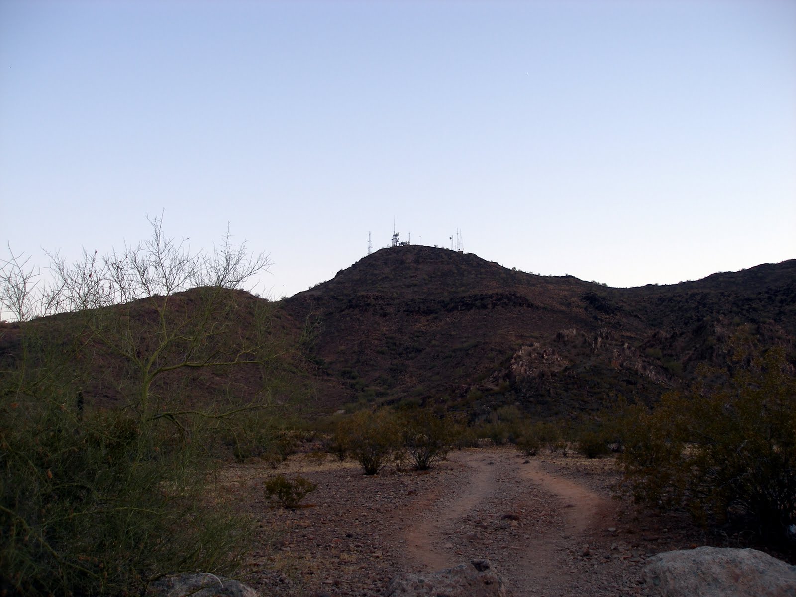
View of North Mountain (looking south)

I arrived at the visitors center around 6:45 and spent the next 45 minutes hiking the preserve and finding some geocaches.  As it got closer to 8, I wound my way around the mountain to where I thought the group was meeting up.  Here is where I was reminded of a lesson in directions.  Maps are in 2D and hills are 3D.  It turns out that the group was not meeting in the parking lot I thought, they were about 1/2 mile south.


The Geocachers meeting at the Ramada


This was no problem as I had plenty of time to hike down to them.  I looked on the map and thought I could get there by following the road up a bit and around the mountain.  Well, I was wrong.  By 8 AM I found myself on top of the mountain looking down at the group meeting up at the location I was supposed to be at!


Scratch that plan.  Since I was already on top, I decided to wait around up top until they made it up.  Killing time was a mixture of relaxing, exploring, geocaching and watching the group work their way to the top.


The group eventually made it to the top.  It was fun to greet them as they passed.  It was even better to have more eyes to hunt the cache I could not find.  (Up on top Cache).  We did not stay at the top long as some in the group wanted to go find a puzzle cache that they had figured out.  We made our way down the backside of the mountain to a different peak.  As we were doing this we passed a sad sight.  There was a dead golden retriever lying under some bushes.  As best we can figure, it must have ran off and made it to this spot.  Very sad site.

We found the mystery cache in short order.  After that, a few guys said that they wanted to head down into the preserve and do some of the caches on the main trail through the preserve.  Since this was my plan, I decided to join them.  We started hiking down the mountain ... right past the "Area Closed" sign.  This was a steep descent.  It was also a quick decent as the guy leading us down is a strong hiker.

We made it down to the valley floor and began our trek on the trail.

Geocaching in the preserve with MikeJF57
I spent the next hour hiking and geocaching with two seasoned cachers.  By the end of the day, I ended up with 15 caches found, 2 DNFs and 1 sore body.

What a Great day!


Sunday, September 11, 2011

9-11-11 Camelback Mountain - Cholla Trail


Length: 3.7 miles

Duration: 2 Hours 40 minutes

Vertical Up: 2313 feet


My track log at EveryTrail


After taking a few weeks off from hiking I was itching to get back to hike.  As it turns out, over the next 7 weeks one of the local Geocachers is doing a "Seven Summits of Phoenix" hike.   His plan is to hike a different summit in Phoenix every weekend for the next 7 weeks.  Today was the Camelback Mountain leg.  Since I'd never been up there, I committed to go.

For those of you who don't know, Camelback Mountain is busy.  Since this is the centerpiece of Phoenix and home to many resorts, there are tons of people who hike this trail.  There are two ways to the top (from the east and from the west).  This hike was on the less busy Eastern side, also known as the Cholla Trail.

Cholla Trail is 1 3/4 mile long with a 1700 foot elevation gain.  The first 2/3s of the trail is pretty standard hiking, with the last 1/3 being difficult scrambling up and over rocky ridge line (using your hands and feet) to the summit.

Parking is a big deal around Camelback.  There combination of expensive houses and packed streets puts parking at a premium.  The side streets up to the trail head are closed to parking (although that does not stop a few stupid people).  The City of Phoenix has done a good job here opening 64th street to parking.  I found a spot on 64th street about 1/2 mile from the trail head.  I gotta say I was amused by the hikers searching for a spot closer to the trailhead.  Your going to hike a mountain people, a 1/4 mile extra walk ain't gonna kill you!


So there we were, 17 of us ready to hike.  The organizer of the event stressed to us that WATER was essential and even brought extra water.  Since I ran out of water on a hike with him last year, I call this the "Brian Speech".  On to the hike...


The Cholla trail rises to the summit of Camelback from East to West, mainly on the north side of the mountain.  In the beginning you are limited to awesome views to the north and east.  As you reach the summit, the whole city comes into view with a pretty spectacular 360 degree view of the city.


Once you reach the trailhead you immediately start climbing.  In the beginning the trail parallels the backside of The Phoenician Golf Course (http://www.thephoenician.com/)


As the trail begins to climb you make your way to the south side of the mountain, getting your first glimpse of The Phoenician, Papago Peak and all of Phoenix.


I felt GREAT on this hike.  All these months of working out and watching what I eat are starting to pay off.   I was in the front group and charged up to the top.  It was really a great feeling to be in shape enough to love a difficult hike like this one.


My group reached the summit in 50 minutes.  Over the next hour, the rest of the group started to trickle in (a bunch of them had stopped at the numerous geocaches on the way up).  I also took the opportunity to find a geocache. Once we all were safely there, a summit picture was taken and the group leader left a flag in honor of September 11th victims.


After a bit more rest and swapping stories with other Geocachers, It was time to go.  On the way down, I scrambled off trail up another peak with a few others to find a geocache (GrĂ¼nes Zinn Geocache).

It was a fabulous day for hiking and a great event!  For those interested, you can read about the event here: SSoP: Camelback

Monday, July 25, 2011

I Really Need a Pepsi


I started this blog in the beginning of the year (2011) as a self encouragement to get my ass out of the house and to hike. I wanted to use it as self-encouragement to hike some of the places I had been reading about.

From January to April that’s exactly what I did. I hiked Daisy Mountain from New River to Anthem and hiked to Indian Mesa. In March, I went on my first hike with the Anthem Hiking Club.

Well, now for a dose of honesty. Sometime in late April, I ran out of my high blood pressure meds. It was a few days before I got in to see the doctor. My doctor’s appointment did not go well. In fact, my blood pressure was “a bit” high and they would not let me leave until it got back under control (with meds). I learned two things that day:
  1. Never run out of meds.
  2. I really need to get myself under control.
So, in the beginning of May I swore off all soda and started counting calories. I would not classify this as a diet as much as just watching how much goes into this 43 year old body.

The first week of the diet was hell. Coming down from soda addiction was torture. I had a constant headache, a short fuse and was shaky a lot. If you have ever been addicted to anything, I feel for you. However, the first few weeks were also great. I was working out every other morning and the pounds were falling off. I was reading a lot about weight loss and lifestyle change and realized I needed a goal. Looking at my progress and at the calendar, I made the goal of losing 25 pounds by July 15th. Totally doable!!!

Well … In mid May I broke my toe and was reduced to little exercise. After that healed, in mid-June my weight loss plateaued. I was no longer dropping weight like it was a hot tamale. July 15th came and I missed my goal. I “only” lost 20 pounds in 2 ½ months. Believe me, I’m not sad about that at all. Looking back, I think I should have been more realistic about my ability to work out every day.

I have read a lot about weight loss, plateaus and how to over come them. I have adjusted my calorie intake and my exercise and am back to consistent weight loss. The new normal for me is trying to loss 1 ½ pounds per week. With daily weight fluctuations, this is incredibly hard to measure.

I have set a few goals for the rest of 2011. The big goal is to continue working out and counting calories. I have set a weight loss goal, although that is not my main focus.

I also need to continue to NOT drink soda … although caffeine continues to call me like a heroin dealer…. “drink me, drink me!”. I have set little goals too. Things like “buy a heart monitor” and “buy smaller underwear” are in there.

I would like to share with you one big goal. I have committed to trying to finish the Phoenix Summit Challenge in early November. The Phoenix Summit Challenge is an opportunity for outdoor enthusiasts of all abilities to climb multiple summits throughout the Phoenix desert preserve system.

This Year’s Climbs:
  1. On South Mountain, Holbert Trail to Dobbins Lookout and back.
  2. On South Mountain, Ranger Trail to National Trail and back.
  3. Piestewa Summit Trail, up and back. Back to Hopi Ramada.
  4. Cross the entrance road, past Mohave Ramada, and up Trail 200 to the summit and back.
  5. Hike up to Lookout Mountain summit and back
  6. From NMVC, take Trail 100, the Christiansen Trail, to Trail 101 (formerly Trail 100A). Trail 101 connects with the road to the top of North Mountain. Hike to the summit, then back down the road and to Trail 101, to Trail 100.
  7. Reconnect with Trail 100 to Trail 306, to the top of Shaw Butte, climbing clockwise. From the top, return on the road, then past the dam and back to NMVC, completing the event there.

From time to time on this blog I want to expand beyond my hikes and try to make sense of some things that have bugged me for a long time. Read it or not – That’s your choice!

Thursday, July 14, 2011

2011 7-14 Mission Peak - Fremont, California


Length: 5.75 miles

Duration:1 Hours 47 minutes

Vertical Up:1969 feet


My track log at EveryTrail


In all the years I have been coming to the Silicon Valley, Mission Peak has always loomed in the distance, begging to be climbed. I’ve seen it with snow on the top, lush green grass and dead brown grass. The summit is usually covered by the low clouds that are so typical here. Over the 20+ years traveling up here, I’ve only managed one attempt to hike this hill. This was back in my inactive days and I failed miserably.

I was up in San Jose on business this week and knew I was going to hike this hill. I even got my boss interested. We decided to go for the hike on a Thursday after work. Well, this meant we got to the parking lot at 7 PM. To our surprise the place was packed. After loosing a prime parking spot to an aggressive driver going the wrong way (must have been from Massachusetts) we followed the long line of cars down the hill a bit and parked on a residential street.

I’ve read a few logs about this hike (like this one) so I knew what to expect. The hike is 6-7 miles round trip and should take 4-5 hours. Since we were starting late, we were sure making the summit was not possible. Now for the hike…

This hike starts out by descending just a bit before beginning a steep initial assent. The first ½- ¾ mile assent was tough on me. I had been up since 4 AM and the combination of an early wake up, full days work and now this hill was really affecting my pace. My boss was very cool and kept encouraging me to keep going (“we’ll rest at this flat section in about 5 minutes’). After ½ hour of hiking, huffing and puffing, I made it to the rest point.

After that the trail is pretty consistent grade up, it follows the terrain of the hill, slowly meandering to the top. The rest did me good and I was able to set a good pace (for me) as we continued up. We passed many people and cows on our way up. It’s a tough hike.


As it approached 8:15, we decided it was too cold for us thin blooded Arizonans and too late to continue. We had no idea how close or far to the summit we were.

So we headed down and made it back to the car in 45 minutes. As it turns out, we only had ½ mile to the summit when we turned around. We probably could have made it if we weren’t so dang cold. It’s winter here!


Total distance of the hike was just under 6 miles and we climbed 1800 feet. Not too shabby for a Thursday evening. Next time, I’m leaving earlier and making it to the top!

Sunday, July 10, 2011

2011 7-9 Sandy's Canyon to Fisher Point


Length: 8.4 miles

Duration:3 Hours 3 minutes

Vertical Up:3176 feet


My track log at EveryTrail


Today’s hike was another hike with the Anthem Hiking club. After a 2 ½ hour drive up to Flagstaff with a van full of people (12 of us) we pulled into the Canyon Vista Campground just south of Flagstaff. This is where the trailhead is located. It was nice to see the folks in the campground roughing it in their 60 foot motor home with their DirecTV dish set up. Is that really camping? There is day parking in the back of the campground. After a quick bathroom break, we got set up to hike.


From the trailhead, you get a great view of the San Francisco Peaks and the cliffs of Walnut Canyon. The trail starts out flat and after about ¾ of a mile you start a descent down into Sandy’s Canyon. The first thing I noticed on this portion of the hike was that I was able to keep up with the hikers that used to fly past me. Inside I was feeling victorious that the last two months of workouts are paying off.


The hike flattens out for a 1 ½ mile flat hike through Sandy’s Canyon. The cool breeze, fresh air and smell of the Ponderosa Pines were overwhelming though the canyon. I was really enjoining myself.


The hike through the canyon crosses paths with The Arizona Trail. As you approach Fisher Point, you take a left turn and begin the ascent up to the top of Fisher Point. This is where I realized that we were at 6500 feet. As the altitude began to take its toll on me I began to drop back from the front group of hikers. The ascent up to Fisher Point is about a mile long and 700 feet up. Interesting contrast on this trail between a properly managed (thinned) forest on one side of the trail vs. a untouched forest on the other. It really shows the need for forest management. I can only imagine what a fire would do to this place.


At the top of Fisher Point we took time out to eat a snack and explore around a bit. Of course the group had to point out where one of the members slipped and fell (almost off the cliff) a few years back. The typical jokes and ribbing were dispensed.


After finishing up our snack, we hauled ass down from Fisher Point. We were really moving, almost jogging down the path. Back down at the bottom we voted to continue deeper into the canyon to look at a couple of caves near by. The first cave was a shallow cave in the side of Fisher Point. It was real interesting to talk to a guy in the club about the rock. This rock was actually a sandy beach 80 million years ago.


Hiking deeper into the canyon (though batches of Poison Oak) we came up on the second cave. This cave was actually a split in the mountain. It was about 150 feet in the side of a mountain and as high as 100 feet in some points. It was also 20 degrees cooler in there. These pictures really do not do it justice as we were walking in pitch black. Of course one of the more jovial members of the group took the opportunity to scare the bejesus out of us with some well-timed animal noises. If I am judging how scared he made me on a scale of 1-10, I would give him a 27.


After a bit of a break enjoying the cool temperatures in the cave, we began the hike back. Again, it was very enjoyable to hike on flat land and take in the smells of the forest.


I must say I really enjoyed this hike and really needed a break from a stressful work week. There are some really cool people in the group and the van ride home was full of stories and joking around. I can’t wait for my next hike with the Anthem Hiking Club.

Sunday, June 19, 2011

Lookout Mountain - 6/19/2011


Length: 1.4 miles

Duration:36 minutes

Vertical Up:719 feet


My track log at EveryTrail


I decided to do a quick father's day hike today. I really wanted to see how my muscles recovered from yesterday's hike of North Mountain / Shaw Butte.


In a few short minutes I was up to the top looking south at the two mountains from yesterday's hike.


This was a short hike and a lot of fun. Even did some jogging!

Saturday, June 18, 2011

Shaw Butte / North Mountain Loop - 6/18/2011


Length: 6.8 miles

Duration:3 hours 07 minutes

Vertical Up:2539 feet


My track log at EveryTrail


Smack dab in the middle of Phoenix is North Mountain and Shaw Butte. These two peaks are part of over 35,000 acres Phoenix has set aside for hikers, bicyclists and equestrians who want to get away from it all without leaving the city. More than 100 miles of trails are available for exploring the beauty of the Sonoran desert.

As part of my recent weight loss regiment, I have been doing some research for my next goal (more on that in the coming months). Ever since these two peaks popped up on my radar, I have wanted to climb them. After doing research at the Arizona Hiking trail index web site, I found a route that would conquer these two peaks in on pass (Click me!).

It’s getting hot in Phoenix now so I had to start REAL early. I woke up at 4:45 and made it to the start of the trail by 5:30. It was light out, but the sun had not peaked above the eastern horizon yet. The first part of this hike was up to the top of Shaw Butte, with the first 45 minutes in the pre-dawn light. After a short hike in, the climb started, and what a start!


The first bit of the trail is switchbacks up the “backside” of the mountain. Once that initial climb is done, you reach a dirt road for the rest of the hike to the top. As the sun came up, the trail ducked behind the west side of Shaw Butte. A turn to the east and I started up the steepest part of the first climb.


When I made it to the summit I looked around for someone to take my picture. I saw these two nice older ladies and asked them … or so I thought. Apparently they did not speak English. They began to pose and I tried to explain I wanted my picture, not to take a picture of them. I walked around up top for a bit, looking over at my next target, North Mountain.

The descent down from Shaw Butte was along a long road that was crowded with people going up (this is the most popular route). Unbelievably I had the urge to run down the trail but resisted because I knew another climb was coming. The 1.5 mile hike down was easy and in short time I was on the bottom on the north side of the park. A short hike later and I was looking at my next ascent, North Mountain.


The transition trail from the preserve to the east side of the trails was fun. It hugs a peak and was not that hard of a climb. This trail dumps you out on the most popular trail in the park, a (closed) road from 7th street up to the top. This trail is packed with people - an eclectic mix of joggers, families and hikers.


I got into a rhythm on this trail and made it up to the top in short order. I gotta say that is one heck of a climb. After a quick break, I found the trail to the backside of the mountain for the decent. No one was taking this trail! The descent was brutal. It was very steep, full of shale (loose rock) and cactus. I only passed 2 people on the descent. It was really hard to believe I was in the middle of Phoneix.

Once on the bottom, it was a short walk to the car and completion of the loop. I was spent, it was hot and I was ready for my post-hike Gatorade.


What a great hike – it kicked my ass!